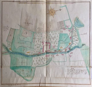
Cadastral Maps of the Domains of the Hochberg Family in Lower Silesia.
[Rohnstock?]: 1772–1774. Original manuscript index and hand painted watercolor maps. Many signed by E. G. Mütz and Gottfried Riedel. Sizes vary, the single sheets are ca. 400 × 250 mm, the folded maps are ca. 400 × 530; 640 × 260; 360 × 460 mm. Maps are titled in German..... More