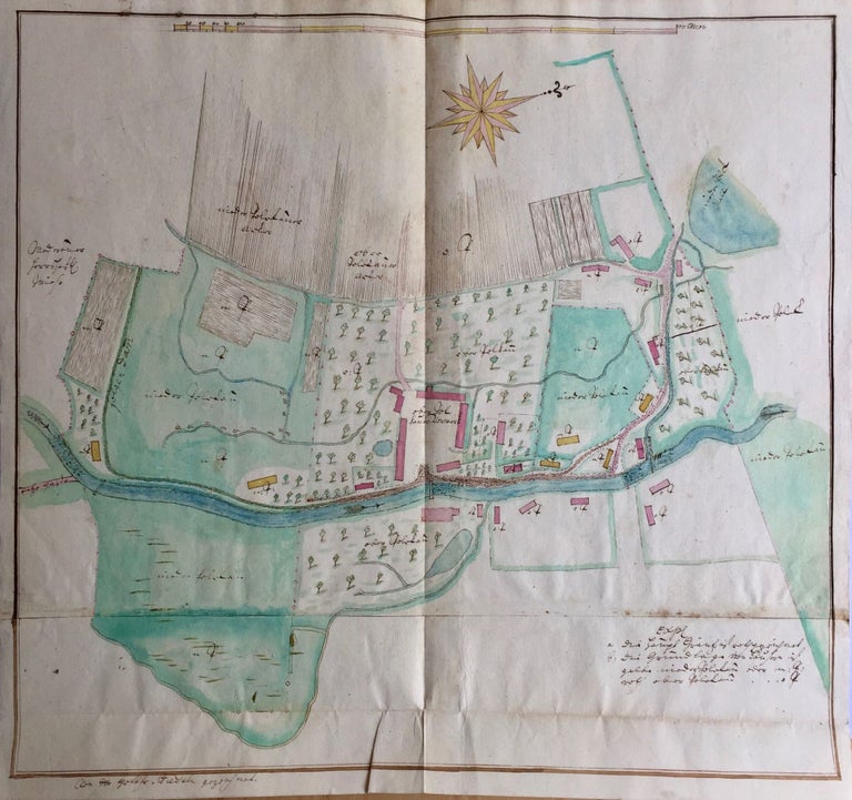
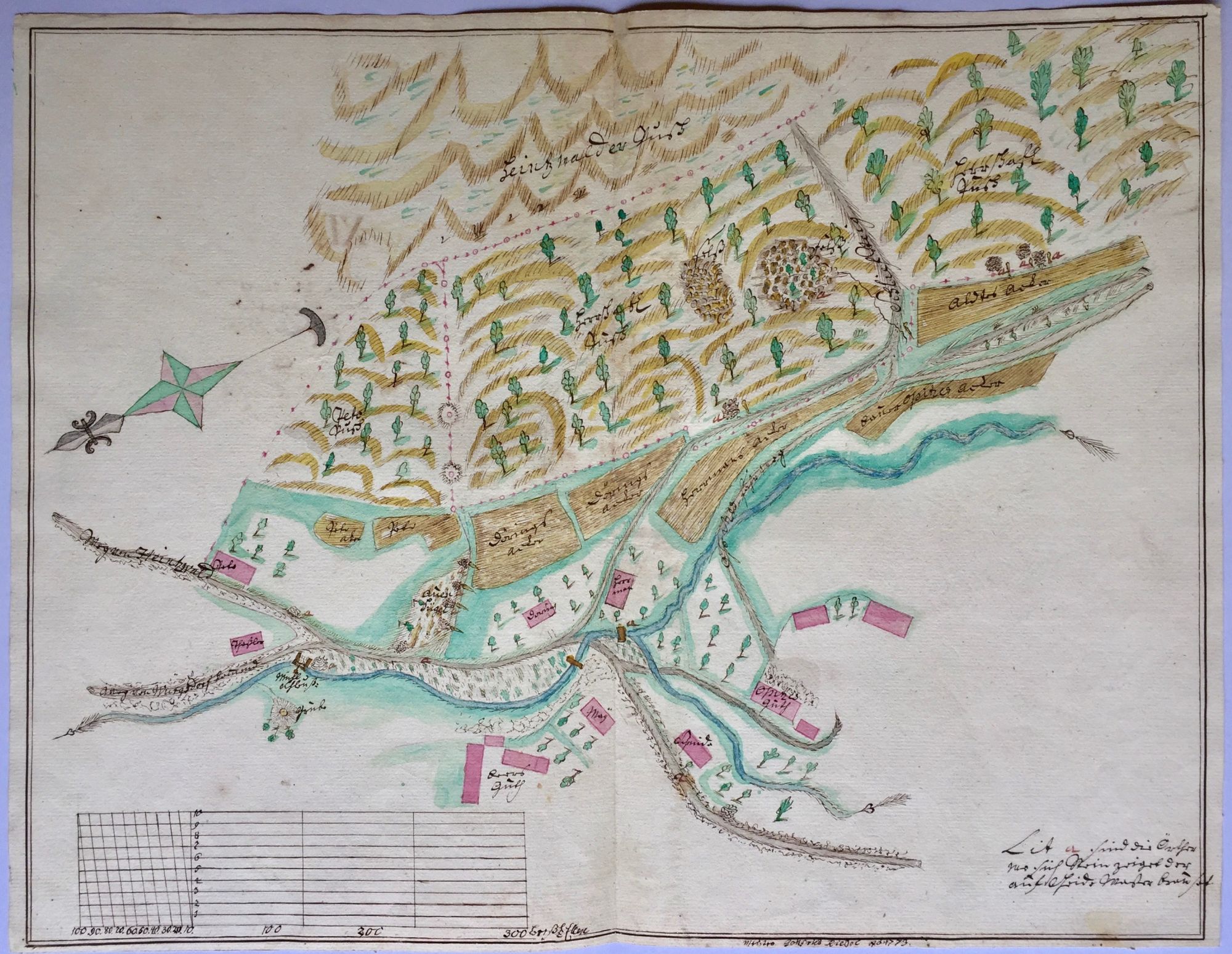
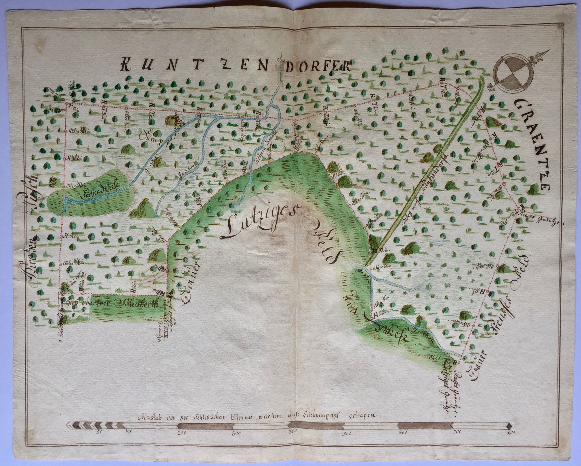
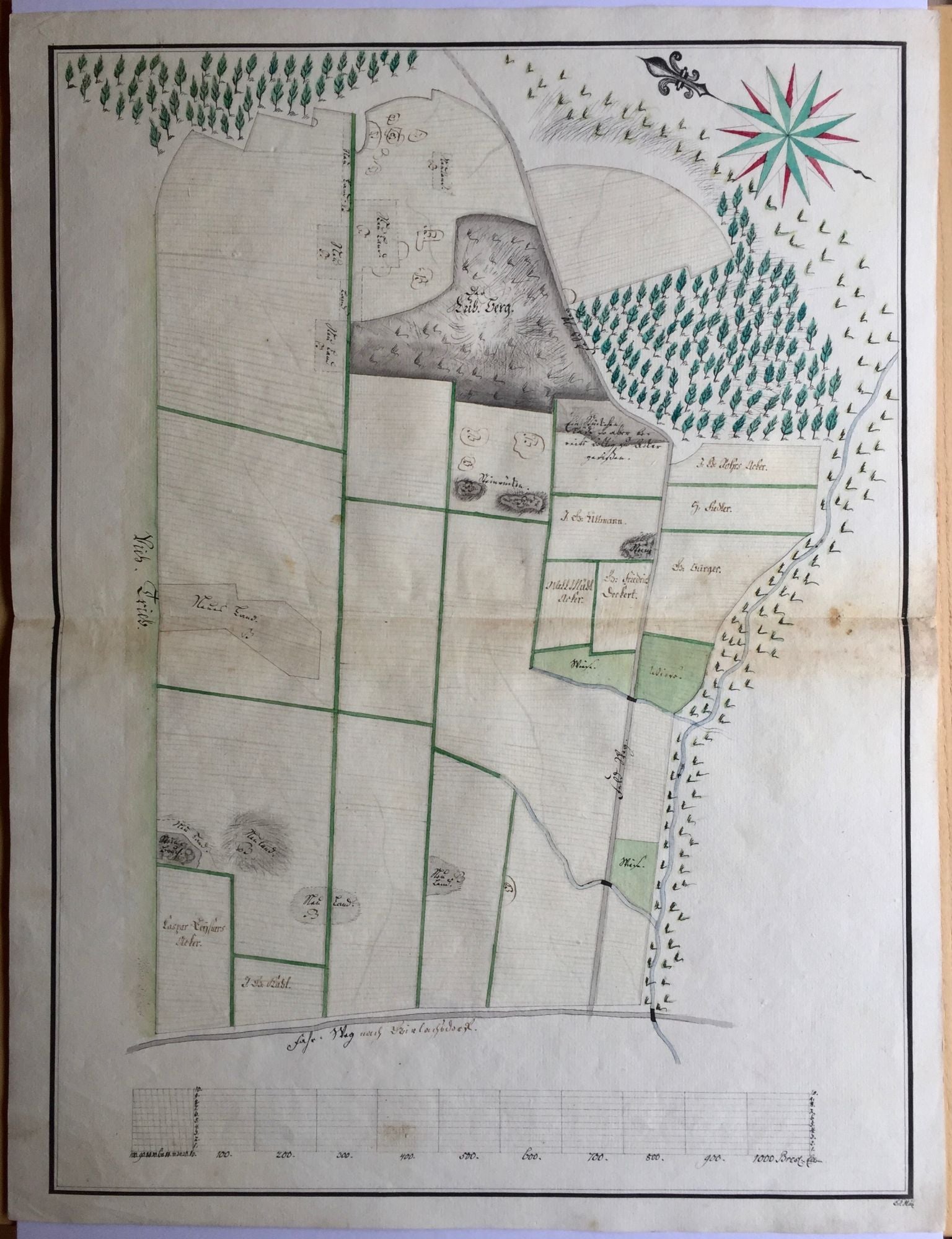
Cadastral Maps of the Domains of the Hochberg Family in Lower Silesia.
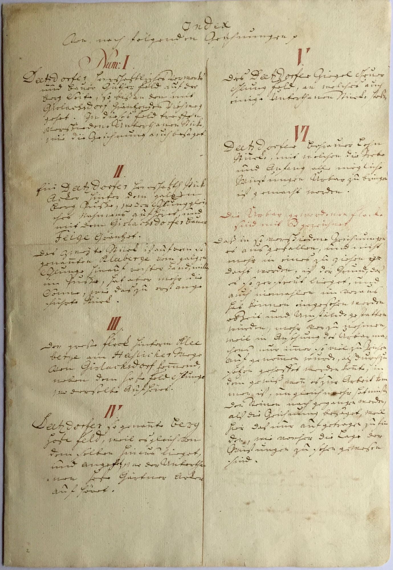
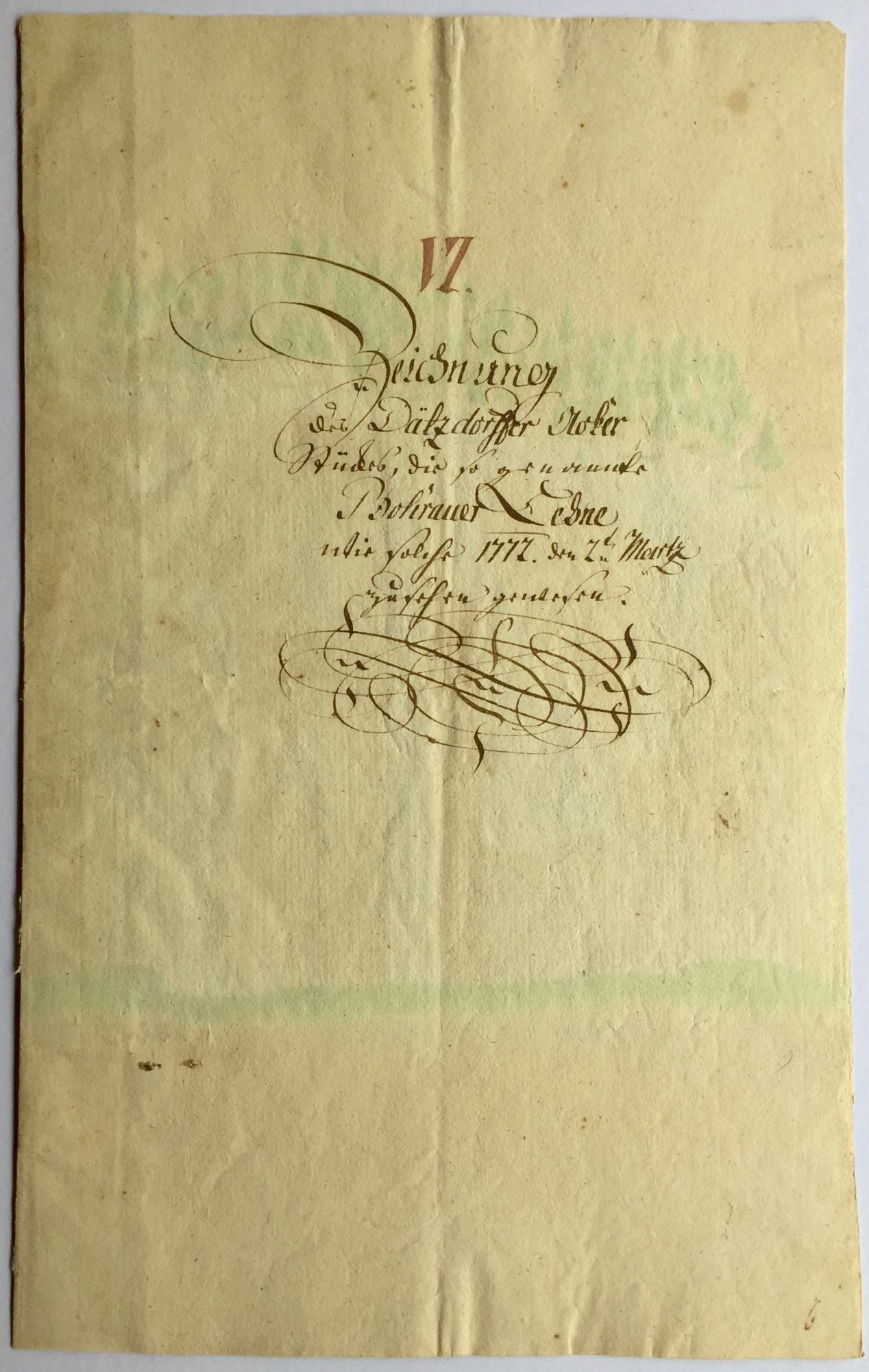
[Rohnstock?]: 1772–1774. Original manuscript index and hand painted watercolor maps. Many signed by E. G. Mütz and Gottfried Riedel. Sizes vary, the single sheets are ca. 400 × 250 mm, the folded maps are ca. 400 × 530; 640 × 260; 360 × 460 mm. Maps are titled in German in ink, the index is written in brown and red ink. (4) pages of index, and 16 watercolor maps (14 folded). Some leaves with light brown stains, more significant at foldings. Sheets are loose, housed in a folder. Restored artistically. Overall in very good condition.
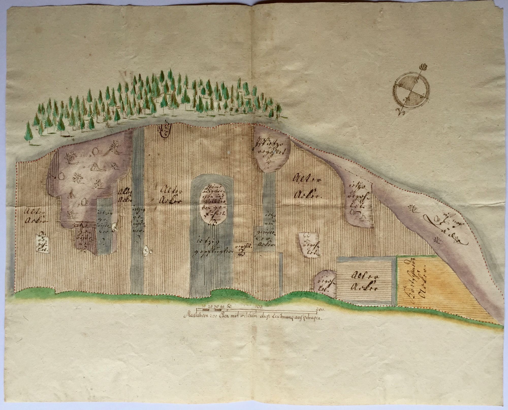
A unique collection of sixteen watercolor, late 18th century, Lower Silesian cadastral maps.
The Lower Silesian Duchy of Pless with its capital Pless (present-day Pszczyna, Poland), belonged to the Hochberg family, who were one of the richest and most influential families in Silesia, holding the titles Baron of Fürstensteins, Count of Hochberg and Prince of Pless.
The first notable member of the family was Konrad I von Hoberg who obtained the castle hill of Fürstenstein (present-day: Książ, Poland) in 1506, thus the history of Hochbergs in Lower Silesia, that lasted until the 1940s, when the Castle of Fürstenstein and other properties were confiscated by the Nazis, started. Throughout the course of five centuries, the generations of the Hochbergs lived here and expanded their domains.
Following the death of Hans Heinrich II von Hochberg (1639–1698), the land had been divided between family branches until the attempt of Hans Heinrich V (1741–1782) in 1764, who tried to unify the family property. In order to keep it intact and within the family he also established a fee tail, a fideicommissum in 1772.
This collection of elaborately painted watercolor cadastral maps were supposedly created in relation to this endeavour, to register the exact locations, dimensions, and cultivations of the lands at Rohnstock (Roztoka) and its vicinity: Dätzdorf (Dzierżków), Girlachsdorf (Gniewków), Günthersdorf (Godzieszów), Thomasdorf (Domanów), Bohrau (Borów), Kunzendorf (Kończyce), Heintzwaldau (Wykroty?). Many of them are dated between 1771 and 1774 and signed by two different hands, E. G. Mütz (I–V) and Meister Gottfried Riedel (VI–16).
.
Price: €6,000.00