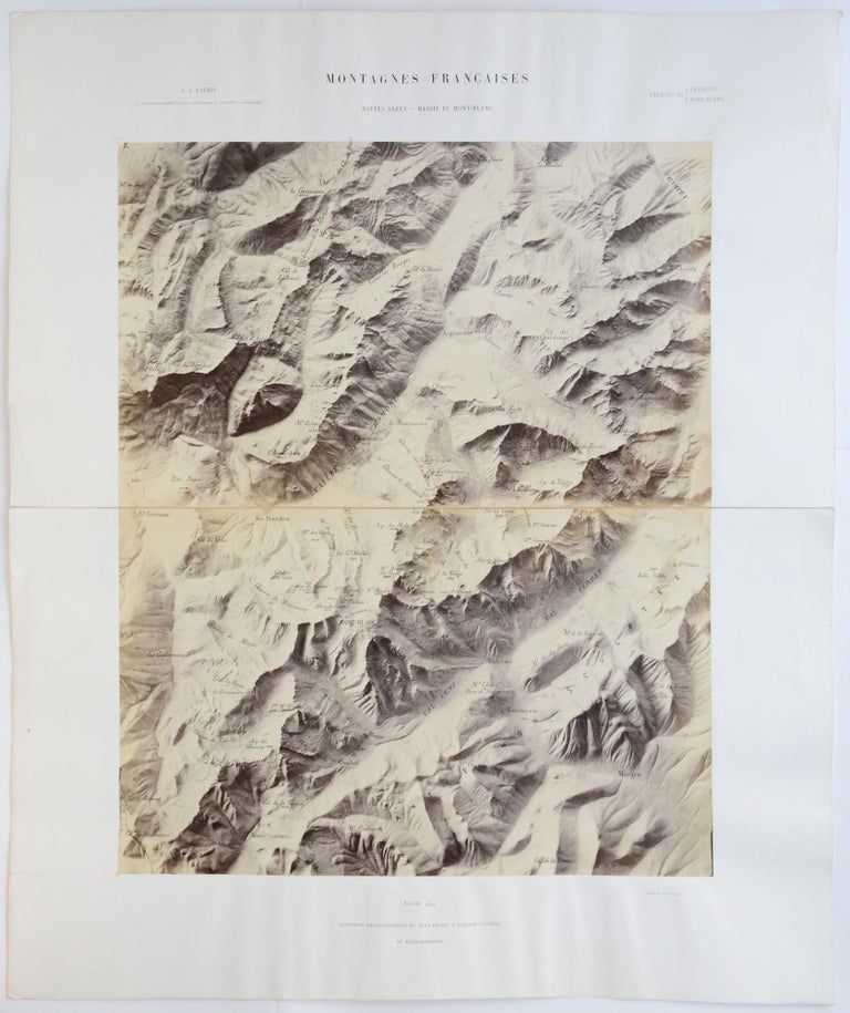
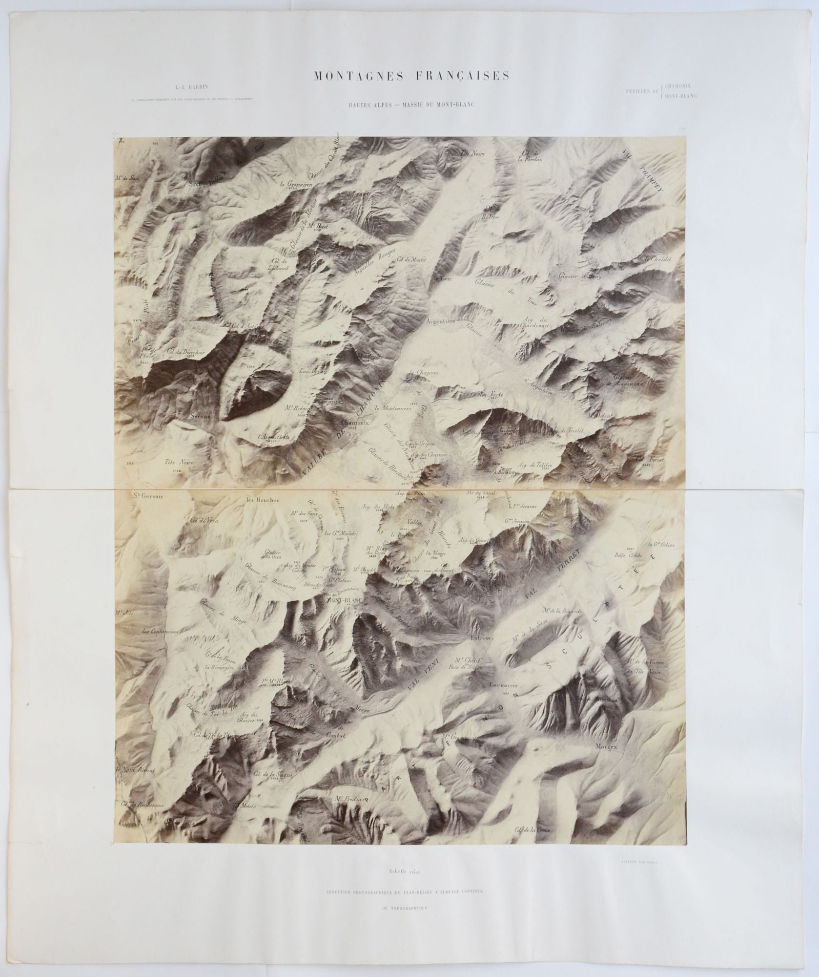
Montagnes Francaises. Hautes Alpes — Massif du Mont Blanc. Feuille de Chamonix Mont-Blanc. Échelle 1/80000. Réduction photographique ou plan-relief a surface continue ou topographique.
Paris: Auguste-Rosalie Bisson, around 1866. Vintage photographic map, with the names of the glaciers, peaks and altitude printed on the photograph in black. Albumen print mounted on cardboard sheets, comprises two sections. Folding strengthened with cloth. Item dimensions: 545 × 650 mm (in two parts). Photograph dimensions: 395 × 489 mm (in two parts). Modest cockling to the cardboard. Small tears to the left margin of both cardboard sections not affecting the photographs. The photographs are in fine condition. Overall in very good condition.
Scarce, nineteenth-century photographic map of the Mont Blanc, created by the French pioneer photographer, Auguste-Rosaline Bisson.
The original, 1:40000 scale relief map, which served as the basis of the present photographic map, was made by Libre-Irmand Bardin (1794–1867), a former professor of the École Polytechnique in Paris who created a series of topographic maps of the most important French mountain ranges between 1864–1866. The relief was made after several topographic surveys, conducted by Bardin between 1863–1864 and it was exhibited at the International Exposition of 1867 in Paris. As such maps were expensive to produce and difficult to handle, Bardin commissioned Auguste-Rosaline Bisson (1826–1900) to make photographic reproductions of his maps in order to make them affordable for a larger audience. Thanks to his refined lighting, Bisson’s images represented the maps in an almost tactile manner achieving the praise of his contemporaries.
Auguste-Rosaline Bisson (or Bisson jeune) is most famous for being the first photographer to take photos from the summit of Mont Blanc. With 25 porters carrying his equipment, he climbed the mountain in July 1861 and took three images on large collodion plates. From the 1840s until 1863 he worked together with his brother, Louis-Auguste Bisson (1814–1876) whom with they run a truly successful photographic firm, employing about 200 people at the peak of their career. In the 1850s, the Bisson fréres “were known as one of the most important photographers not only in France, but in Europe as well.” (Hannavy, 2008) They were active in all genres of the medium, taking portraits, architectural, landscape and reproduction photographs. They met the Alsatian industrial and geologist, Daniel Dollfus-Ausset (1797–1870) in 1854 who commissioned them to take photographs of the Alps for his research on the glaciers. As a result, the Bisson brothers created a great number of remarkable images of the French, Swiss, German and Italian Alps. After their firm got bankrupt in 1863, mainly because of these expensive expeditions, August-Rosaline and Louis-August continued their career separately.
Extremely scarce, we could trace only one copy of this sheet of Bardin’s maps in institutional holding, in the National Museum of Natural History in Paris.
Bibl.: Bardin, Christophe. Relief du Mont-Blanc. In: Le Globe. Revue genevoise de géographie, tome 5, 1866. pp. 195-207.; Dollfus-Asset, Daniel; Savy, F.: Matériaux pour L’étude des Glaciers par Dollfus-Asset. Paris: Libraire des Sociétés Géologique et Météorologique de France, 1868. 480–485 pp.; Hannavy, John: Encyclopedia of Nineteenth-Century Photography. Volume 1 A–I. New York: Routledge, 163 p.; LeBleu, M.: Rapport de M. LeBleu, ingénieur des mines, sur les plans en relief, présentés par M. Bardin, à la Société industrielle de Mulhouse. – Séance du 27 Juin 1866. In: Bulletin de la Société Industrielle de Mulhouse. Mulhouse: Imprimiere de P. Baret, 1866. 387–394 pp.
.
Price: €2,500.00