![Item #1570 [Photo Album of] Jerusalem 1865. James McDonald, Henry James, Peter Bergheim.](https://foldvaribooks.cdn.bibliopolis.com/pictures/1570.jpg?width=768&height=1000&fit=bounds&auto=webp&v=1555505141)
![[Photo Album of] Jerusalem 1865.](https://foldvaribooks.cdn.bibliopolis.com/pictures/1570_2.jpg?auto=webp&v=1555505141)
![[Photo Album of] Jerusalem 1865.](https://foldvaribooks.cdn.bibliopolis.com/pictures/1570_3.jpg?auto=webp&v=1555505141)
![[Photo Album of] Jerusalem 1865.](https://foldvaribooks.cdn.bibliopolis.com/pictures/1570_4.jpg?auto=webp&v=1555505141)
![[Photo Album of] Jerusalem 1865.](https://foldvaribooks.cdn.bibliopolis.com/pictures/1570_5.jpg?auto=webp&v=1555505141)
![[Photo Album of] Jerusalem 1865.](https://foldvaribooks.cdn.bibliopolis.com/pictures/1570_6.jpg?auto=webp&v=1555505141)
![[Photo Album of] Jerusalem 1865.](https://foldvaribooks.cdn.bibliopolis.com/pictures/1570_7.jpg?auto=webp&v=1555505141)
![[Photo Album of] Jerusalem 1865.](https://foldvaribooks.cdn.bibliopolis.com/pictures/1570_8.jpg?auto=webp&v=1555505141)
[Photo Album of] Jerusalem 1865.
[Southhampton]: [1865–1866]. Private album of 41 original, vintage mounted albumen prints (ca. 72 × 100 mm) and two printed papers by Henry James. Bound in red morocco. Panels with gilt ornamented rules at the edges, front panel with the royal coat of arms of the United Kingdom, inner edges gilt. Presentation copy, inscribed by P. McIntosh, a soldier of the Royal Engineers to Philip Hankinson Newnham (1832–1887) in Southhampton, in 1866. 8, 4 p. (21) leaves. Binding rubbed at extremities, otherwise in fine condition. Some foxing throughout and occasional stains to the papers. A few photos faded, the majority are sharp, all in fine condition.
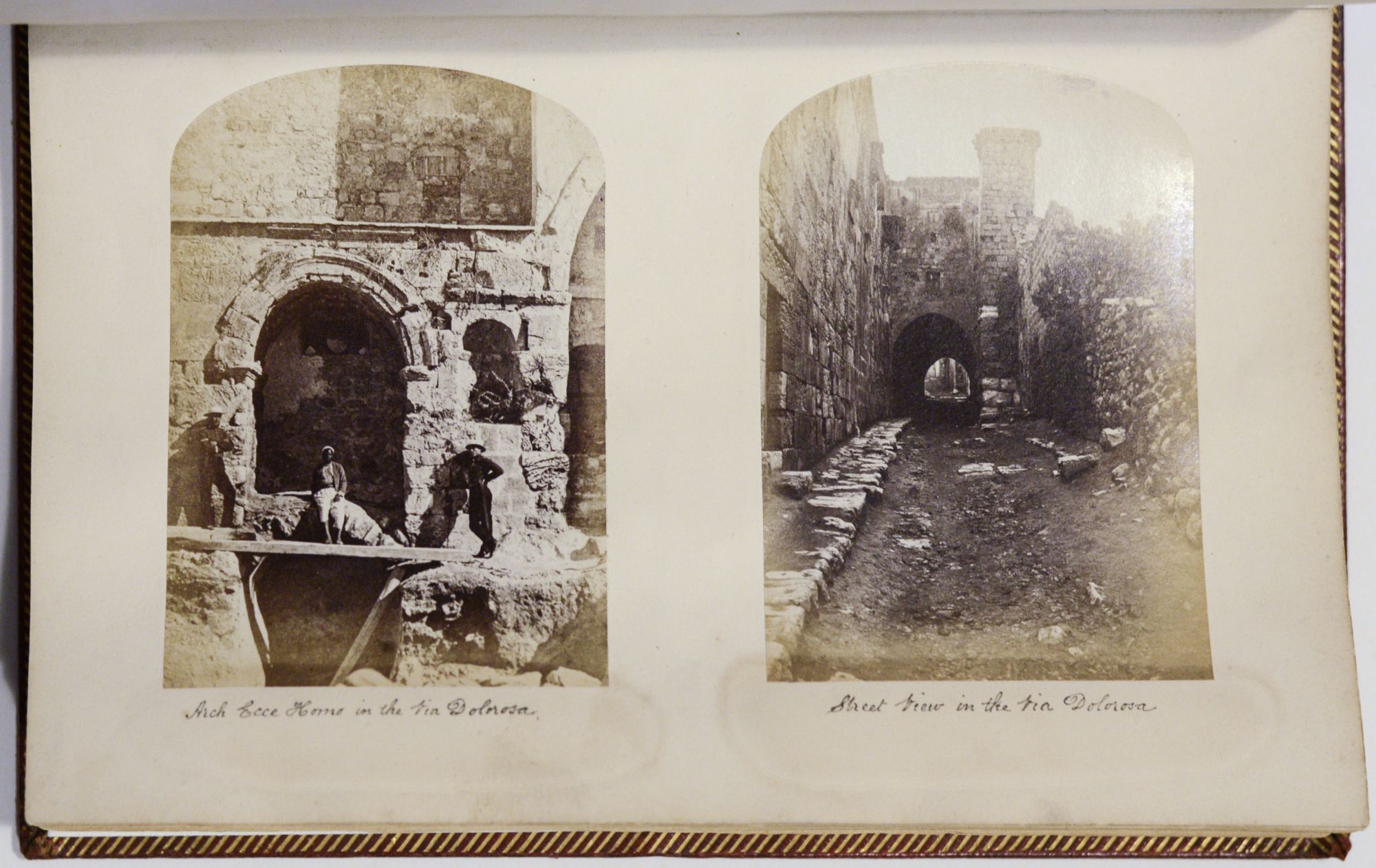
Forty-one early photographs of Jerusalem and its surroundings by James McDonald and Peter Bergheim, created in relation to the 1864–1865 British Survey of Jerusalem.
The Ordnance Survey of Jerusalem by the British Royal Engineers was the first modern cartographic and archeological survey of Palestine. The expedition, directed by Colonel Sir Henry James and led by Captain Charles Wilson, was commissioned in response to the unhealthy state of the water supply in Jerusalem, then a rather neglected province of the Ottoman Empire. The contingent was responsible for levelling the land from Jerusalem to Solomon’s Pool, and investigating the nature and extent of the water supplies of the city. Besides these works, and making the first modern map of Jerusalem, one of the engineers, Sergeant James McDonald was equipped with a photographic apparatus and took photographs of the historic sights and the topography, and documented the architectural and archaeological details of the city.
The result of the Survey is the monumental “Ordnance Survey of Jerusalem”, which was published in 1865. The three-volume work is illustrated with more than seventy photographs taken by McDonald, and three by Peter Bergheim, who was one of the first resident photographers in Palestine (one of his images, titled the “Wailing Place of the Jews” included into the present album too). McDonald’s photographs were also available for purchase from the Ordnance Survey Office in Southhampton (Schwartz, p. 233.). This album is supposedly a compilation of forty-one of such images, whose vast majority are not identical to those published in the book.
McDonald’s work is considered as one of the most important early achievements in the photography of the Middle East, and his photographs are the authoritative source of ancient buildings of the Holy Land.
The volume also contains two papers by Henry James, the director-general of the Ordnance Survey. The first is an eight-page account of the Weekly Evening Meeting of the Royal Institution of Great Britain held on February 16, 1866, “On the Ordnance Survey of Jerusalem”, wherein James summarized the aims and achievements of the expedition, and the second, his “Report on Levelling from the Mediterranean to the Dead Sea”, an offprint from the “Proceedings of the Royal Society. No. 84”.
Bibliography: Schwartz, J. M.; Ryan, J. R.: Picturing Place, Photography and the Geographical Imagination. London, New York: I. B. Tauris, 2009. pp. 232–234.
.
Price: €22,500.00